Siargao is the Surfing Capital of the Philippines
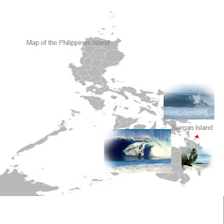
Siargao Island is a tear-drop shaped island in the Philippine Sea situated 800 kilometers southeast of Manila in the province of Surigao del Norte. It has a land area of approximately 437 square kilometers.
Surfing Capital of the Philippines
Siargao Island contains the largest mangrove forest reserves in Mindanao, at Del Carmen. Long stretches of wetlands indicate a potential for commercial seaweed propagation.
Siargao Island is situated at a coordinate of 9°52′N 126°03′E / 9.867°N 126.05°E / 9.867; 126.05. It is composed of municipalities of Burgos, Dapa, Del Carmen, General Luna, San Benito, Pilar, San Isidro, and Santa Monica.Siargao Island is greatly influenced by the winds and currents coming uninterrupted from the Pacific Ocean, intensified by the Mindanao current running westward through the Siargao Strait.
The Island's Pacific-facing reefs are situated on the edge of the Philippine Trench, and the extremely deep offshore waters assure the ocean swells have undiluted power when they encounter the many coral and rock reefs. Siargao has excellent surfing conditions, particularly during the southwest "habagat" monsoon from August to November, when the prevailing wind is offshore.
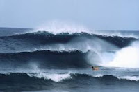
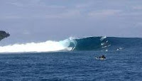
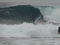
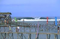
One of the best known surfing waves on Siargao and the Philippines, with a worldwide reputation for thick, hollow tubes is "Cloud 9"[citation needed]. This right-breaking reef wave is the site of the annual Siargao Cup, a domestic and international surfing competition sponsored by the provincial government of Surigao del Norte.
The wave was discovered by travelling surfers in the late 1980s. It was named and made famous by American photographer John S. Callahan, who published the first major feature on Siargao Island in the United States- based Surfer magazine in March 1993, and hundreds of his photos in many other books and magazines since his first visit in 1992. Callahan has put the island on the international map and has drawn thousands of surfers and tourists to Siargao. Cloud 9 also has a reputation for being a relatively cheap destination for surfers with many cheap accommodations and restaurants and bars to choose from.
There are several other quality waves on Siargao and nearby islands, but Cloud 9 has received more publicity than any other, indeed in the Philippines as a whole. It is the only wave easily accessible without a boat, leading to overcrowding and the nickname of "Crowd 9" among surfers. Eager foreign and locally owned accommodation and tourist facilities have profited from the magazine publicity and the influx of visitors drawn by the annual Siargao Cup competition in September.
Siargao's "Cloud Nine", a powerful hollow right hander, featured in "Surf Magazine" as one of the ten best waves in the world. East of Siargao Islands lies the Philippine Deep that rises from over 34,000 ft to a belt of reefs. This Oceanic trench is the reason for the excellent surf in Siargao; because it is so deep and the continental shelf narrow, the waves break with juice straight out of deep water and focus the wave energy straight at the beach. This area is set to become Asia's next hot surfing destination and is truly one of the worlds' last great frontiers for surf exploration.
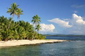
Siargao Island is Surigao Del Norte's "last frontier" facing the Pacific Ocean. The island boasts of quite a number of untapped natural resources that tourists marvel. Aside from the white beaches that abound, the seas of Siargao are the fishermen's choice to catch fish and other marine products. This year, under the administration of Gov. Robert Lyndon Barbers, Siargao's infrastructure development got the much needed "shot in the arm" with its people seeing and feeling the improvements where during the previous provincial leaderships, "it was only but a dream," so they said.
"Gen. Luna Municipality"
The historical Origin of this municipality dates back to the time when it was still a Barrio called Cabuntog. During the early Spanish era this barrio had a church bell that was so big that whenever it was rang, it could be heard as far as the Mindanao mainland.
The inhabitants fearing the repeated depredations of the marauders in the barrio finally decided to throw or drop (buntog) the bell into the Campuhong River. Hence, Cabuntog after the words Campuhong and Buntog.
Although Cabuntog was already a municipality in the Spanish regime, it was during the American Administration that it was formally organized into the municipality of General Luna, its present name. It was inaugurated on August 1, 1929.
"the Municipality of Pilar"
The town is situated at the eastern sea-coast of the island of Siargao on the side of a small gulf directly facing the vast Pacific Ocean, and approxiamtely 200 nautical miles from the Philippine Deep.
his town has also a good surfing spot located at Salvacion. This is one small village in Pilar. It is about one hour drive if you are living in General Luna. If the waves at cloud 9 are not good, surfers would usually hop on their bike to get there. The motorbike ride in itself is already exciting so that adds the adventure.
How can you miss the attraction of the famous magpupungko? This is a rock formation, surrounded by limestone and granite sculptures facing the Pacific Ocean, its pockmarked limestone floor reveals pools of assorted shapes and sizes resembling basins, barrels, tubs and ponds during low tide.
"The Municipality of Del Carmen"
|
|
This was the place of the legend about the very powerful bell that was dumped in one of the lakes (vito) at Haoyon now Cancohoy rose. It was said that this bell was made of pure silver and that its sound could be heard even up to Bucas Grande Island, thereby (ironically) inviting the Moro pirates to come and pillage the people using the sound of the bell as their guide. The fathers again decided to transfer to Campohag for expansion and for better security from the Moro.
In 1920, at the assumption of Francisco Alburo as town president, Numancia territory comprised one half of Bucas Grande with the barrios of Pamosaingan, Sta. Cruz and Hinundayan, in Siargao Island. Beginning from Barrio Bitoon as boundary, between Dapa and Numancia, up to barrios Tuburan, Quezon, Langdahan (now Sta. Paz), straight to Binoni Point as boundary between Numancia and Pilar, and all lands extending North of this line now comprising the new municipalities of Sapao, Burgos and San Isidro, were also included.
"Dapa Municipality"
In the old Generation Dapa town Called corrupted from the vernacular word hapa, was adopted by the natives as the permanent name of their settlement in lieu of Taghaligui to constantly remind them of those vicious mororaids.
 Sometime in the early part of the last century of the Spanish regime, Moro piracy was rampant in the Southeast coast of Mindanao. Pirates occasionally swooped down on the coastal village of Siargao Island and left behind them destruction and death. Natives were often taken as captives and slaves. Due to frequent raids, the villagers abandoned their homes and sought haven in Taghaligui (now Dapa) which was then a lush timberland and protected from the shore with a thick formation of tall mangroves.
|
|
"Burgos Municipality"
On Northeastern portion of Siargao Island, facing in the Pacific Ocean, the small town of Burgos.
It has six Barangays such as Poblacion 1, Poblacion 2, Baybay, Bitaug, Matin-ao and San Mateo.When the Spaniards came, they lived as a group in Unidad, a Sitio means a little barrio.
Afterwards, it was renamed Barangay Burgos in 1925 during the American regime with the seat of Municipal Government of Numancia now Del Carmen. As Sapao became a district town 1955, Burgos apllied for a townshipstatus with the assistance of Congressman Reynaldo Honrado who requested President Diosdado Macapagal to approve it. His Excellency issued Executive Order No. 293, dated November 29, 1965, converting barangay Burgos into a Municipality."Municipality of Socorro"
A band of more than a thousand fanatics led by Francisco Bernales alias Lantayog, with bolos called "linatip," almost completely annihilated a platoon of soldiers sent to Socorro to drain the colorum sacred bathing pool called "tangke".
Only two members of the platoon who were aware of the colorum tactics were left alive. In retaliation, then Governor Pedro Coleto wired a report of the Socorro incident to GOVERNOR Leonard Wood, who sent troops under general Bowers, which in turn mercilessly shelled Socorro, where many of the colorums perished.
The survivors continued their plan to saeize the municipal and provincial governments of Surigao town. They are surprised and annihilated by constabulary forces in Tubod where now lies a common grave of sixty-four colorums. This was sufficient to disband the fanatic society."Pob. San Isidro Del Carmen Municipality"
Little is known about the past and present of this municipality. Knowledgeable residents of the place like its municipal officials then were for some unknown reasons unable to provide the publicity committee with even a brief information on its history, its struggle for autonomy, its achievements and progress and its blueprints for development.Except for some bits of information gleaned from the office of the Governor then, not much can be written about San Isidro.
Before the municipality became a separate political subdivision in 1960, it was a part of Numancia. It was said that before the barrio was linked with a road to its mother town where the high school is, only very few succeeded in getting a secondary education.
In those days, the best and shortest way to reach Numancia was to travel on foot through a trail which wound through mountainous ranges and muddy terrain. With the construction of roads later and the opening of more s chools in those towns and barrios, San Isidro has not only filled the need for the adequate education of its inhabitants but has also improved its economic pace.From the scant information gathered, San Isidro was the fourth of the five new municipalities in Siargao to be created. It was categorized 7th class municipality." San Benito Mucipality"
They were fascinated with the vast array of blooming Talisay Tress in the place where the Municipality of San benito presently stands. Theire enachanment made them to name the place "Talisay". After exploring the place and observing the cultural behavior of the people, a chapel was built bearing the relic of Saint Benedict. After a couple of years. Talisay was changed to San benito in honor of Saint Benedict, its patron saint.
San Benito became a civil barrio of Sapao. When Sapao was reverted to a barrio by virtue of an executive order of the Military Governor, San Benito was then ceded to Numancia, now Del Carmen, and became its largest barangay. It was Congressman Constantino C. Navarro, Sr. , who proposed and sponsored a bill for the creation of San Benito as a new municipality.
After complying with the formalities and legal requirements, on September 17, 1971, Republic Act No. 6396 came into being creating theMunicipality of San Benito. Presently, the town is composed of six (6) barangays, namely: Talisay, Sta. Cruz, Nuevo Campo, san Juan, Bongdo and Maribojoc. TheMunicipality of San Benito is one of the richest fishing grounds in siargao Island fishing ranked second in terms of source of income of the people.
"Sta. Monica Mucipality"
Sta. Monica is a 5th class municipality in the province of Surigao del Norte, Philippines. According to the 2000 census, it has a population of 7,757 people in 1,459 households.
Santa Monica is politically subdivided into 11 barangays. Abad Santos, Alegria, Bailan, Garcia , Libertad, Mabini, Mabuhay (Pob.), Magsaysay, Rizal, T. Arlan (Pob.), Tangbo.
Santa Monica is politically subdivided into 11 barangays. Abad Santos, Alegria, Bailan, Garcia , Libertad, Mabini, Mabuhay (Pob.), Magsaysay, Rizal, T. Arlan (Pob.), Tangbo.
"The Siargao Airport"
Siargao Airport, is an airport serving the general area of Siargao Island, located in the province of Surigao del Norte in the Philippines. The airport is located in Barangay Sayak in the municipality of Del Carmen, where the airport derives its name from.
The airport is classified as a feeder airport by the Air Transportation Office, a body of the Department of Transportation and Communications that is responsible for the operations of not only this airport but also of all other airports in the Philippines except the major international airports.
"Siargao Cloude 9 Picturial"
Subscribe to:
Comments (Atom)
